

|
|
August 9th 2010, it has been 19 days since my last storm intercept so I was delighted to see the models favour this day as yet another chance of chasing Summer thunderstorms. GFS had been trending on this for some time however the instability was never significant enough to get too excited about, however that didn't bother me as I'm always up for chasing any set-up, after all it's these lesser events which often produce unexpected surprises. Things suddenly got more interesting during the morning GFS run as the instability got upgraded to 600 CAPE and LIs of -2 in a returning polar maritime airmass (post frontal) with an active showery trough moving through during the forecast period. Lapse rates were very good, plenty of solar insolation was predicted and there was strong wind shear so there was a risk of multicells and a tornado. From looking at the CAPE values it was obvious that the action would begin later than usual with the greatest instability occurring during the late afternoon and early evening in a SWly, then later a Wly flow. From studying the charts it was obvious that the best place to be was in the N of the country especially the coastal regions so that's where I had planned to go.
I was up at 08.30 anyway to keep an eye on the developments as I didn't want to miss out on anything. Thankfully the sky here was completely clear and blue with significant solar heating after the passage of a front during the early morning hours. Trains of young cumulus began to develop by mid day and by early afternoon cumulus med and small towers began to go up so things were looking good indeed. The radar showed showers breaking out in NW NI and with each update they were getting more intense and gradually moving inland so it would soon be time to chase. There was still plenty of time to kill so I went into town and had a nice launch to fuel me with energy for the long day ahead, it's hard to beat a good panini, slice of warm apple pie, and conversations with a few people in the town about storms, I mentioned that fact I was planning on going chasing soon, this got a mixed response as people who knew nothing of the subject expressed surprise since it was warm outside, so how could there be storms?, other more learned observers had no doubts what so ever as the convection outside was telling a story of its own.
I went back home for one last check of the radar, it was all good, wide spread showers where breaking out all over NI with an abundance of good echoes towards the N coast. 'Snowbie' from the Irish Weather Network forum had issued a specific convective forecast for NI which was very much appreciated, he too suggested that the coastal regions at Donegal, Derry, and Antrim could be the best places to be as there was a risk of funnel clouds and waterspouts in those areas, this confirmed my target area so I was 100% committed to chasing to the N coast. It was approaching 15.00 BST which was a good time to leave as the higher instability was now moving into N regions. I would have no mobile internet today so before I went I contacted NI chaser Paul Martin via Facebook and asked him if he could keep me updated on the radar, Paul replied just in the nick of time and passed on his mobile number which was fantastic.
I hit the road, I brought my Mum along with me too since she was on holidays and is quite interested in storm chasing based on what she had seen before over the last year or so. I was glad to have the company because I've been used to having someone along with me for the majority of my 2010 chases. My usual partner is Conor McDonald however he has been very busy lately with a full time photography job and hasn't had the free time to chase over the last few weeks so I was glad to have another set of eyes on the sky and on the road. This was a great luxury as it meant I didn't have to drive so I could instead concentrate on taking images and video clips from the car while on the move, this proved fortunate because if I had been on my own I would have had very few images for this account.
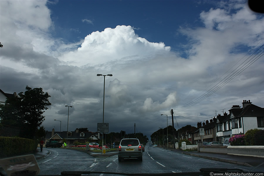
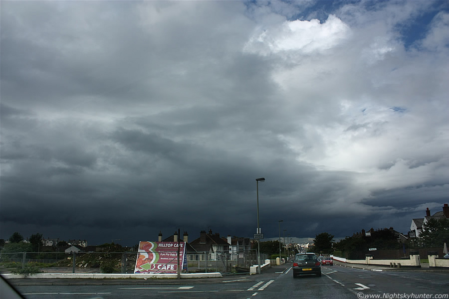
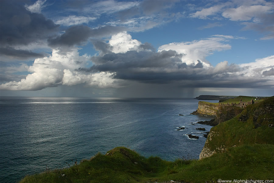
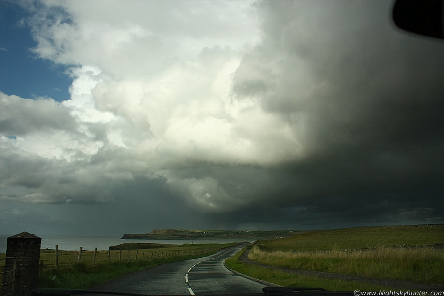
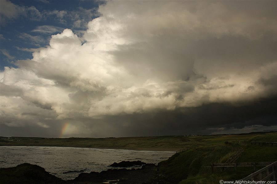
It's not often after one begins a chase that they see something cool literally within min's of leaving the house, however this is exactly what happened this day. We made a R turn off the Crewe Road and joined the main Coleraine Road heading N through a heavy shower, once we cleared the precip I immediately spotted a huge cell on the horizon towards the N or just W of N, at first I thought I was mistaken, perhaps it was just some strong mid level convection because streamers of mid level cloud blocked the lower extremities, however as the mid level clouds stirred open in a lazy fashion, due to the SWly breeze, I got a glimpse of the lower region which confirmed that this was indeed a major cell. I could see the solid white top catching the Sun, as it turned out this was a thunderstorm over the Atlantic Ocean, and I could see it from Maghera which was unreal, it must have been easily 30-40 miles away from us. It was obvious that this was our main target so we continued directly N to intercept it. I took many still images of the cell as we slowly closed the gap between it and us as we drove through various villages and towns. The above image was taken from outside Garvagh, the cell was slowly moving L to R, as you can appreciate from this far inland it must have been a beast to have been seen so well from here, I was getting very excited at this stage and knew I had made a good decision to chase to the coast.
 |
N side of Coleraine, a large and busy town. There where two road options we could have taken here, the L option takes you to Portstewart and the R to Portrush. My original plan before leaving the house was to check out Portstewart as this was the first major down beside the Ocean, my intention was to park there and watch for convective development then work my way along the coast to chase anything of interest. That plan was forgotten now since we already had a visual on an outstanding cell in front of us, it would have been foolhardy to ignore this one so I insisted on going to Portrush, straight ahead. The cell was moving to the R so I figured if we were really lucky we might just intercept it before it passed through, this was going to be very hit and miss as we had a good distance to go yet and I didn't want to end up seeing the back of this storm and miss out on a good photo opp along its leading edge as I was sure there was going to be a good gust front.
 |
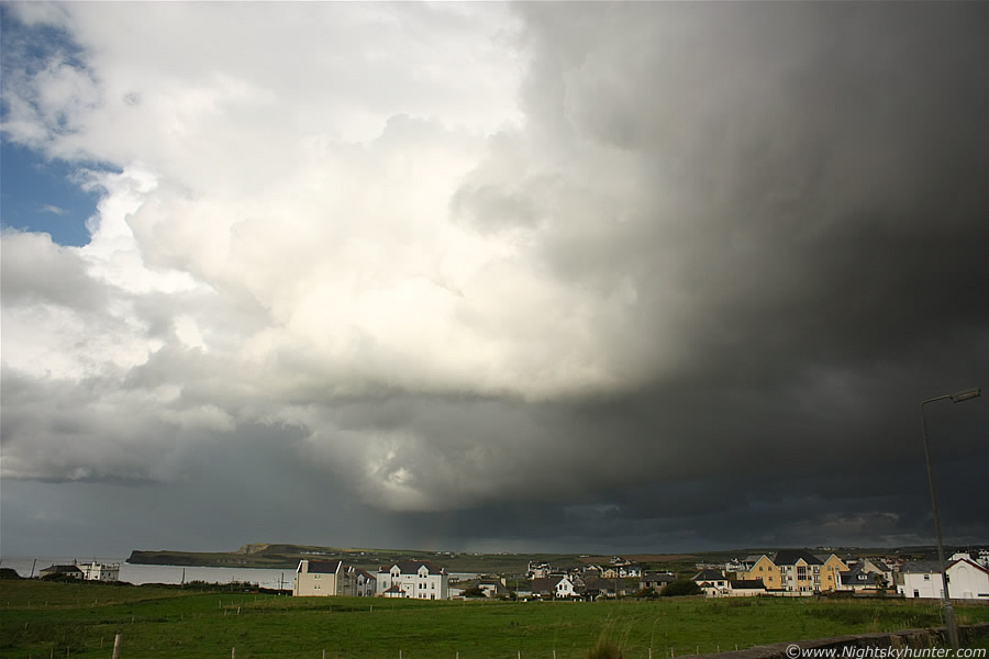
What a beast, even these images don't show how massive and solid this thing was. The top of this updraught exhibited constant changes in shape as it morphed from a horizontal block to a big mound of convection exploding upwards with real time expanding development. Wide angle images never convey the true height of storm cells like the way the Human eye interprets a scene, in reality I was able to look UP through the windscreen to see the top, thank goodness there was clear blue sky around that top. I have another image taken shortly after this which shows that this was actually a multicell storm, I could see several huge Cb Calvus tops and at least one Incus anvil at the rear, behind all of these was a row of dark updraught towers exploding up at the flanking region with others along the side of the mulitcell, it was an impressive system. Our target area, Portrush, was straight ahead by taking the A29 road off to the R, you can see the direction on that road sign.
 |
One of many roundabouts on this chase, Portstewart is the L option, Portrush is to the R on round, it didn't take a genius to decide on which direction to go, the storm was drifting R so we needed to head towards it and ahead of it's path if we wanted to intercept it in good time, this was a make or break moment as the decision was up to me, it took me about 1/2 a sec to say R - Portrush. At the same I was studying a detailed road map which I had recently purchased for chasing, with it I was working out the roads we needed to take to catch up with this storm, it was my intention to get in front of it and watch it approach, if I succeeded in doing that then I would be happy. Check out the tilted updraught on the leading edge of the storm, it's leaning over due to the shear which meant this storm was now organised. You can just about make out the anvil of another cell behind it to the L. Mid level cloud accompanied these cells like a shadow, it never wanted to part and provide me with a good structure shot, I was anxious to make a visual on the base to see what was happening below, it looked extremely dark in that direction with new convection/towers bubbling up vigorously along it's flank.
 |
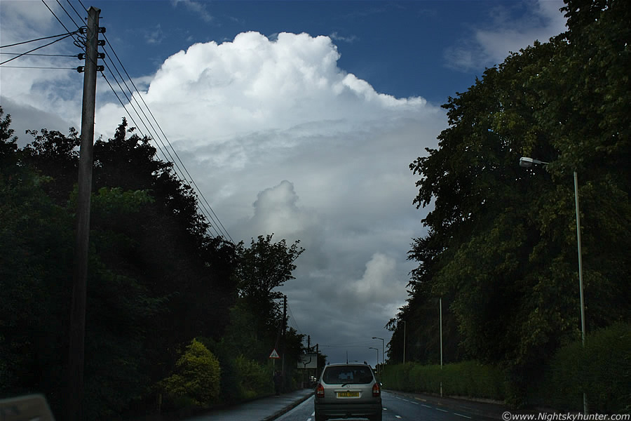
Now past the roundabouts and onto nice open countryside as we drove with purpose towards Portrush. It felt very warm and humid inside the car despite two windows down and the air conditioner on. The Sun was breaking out which I was delighted to see, that meant more solar insolation which would help fire up convection. That mid level cloud was really blocking the structure, at this time I assumed this cell was over land, I was completely unaware that it was over the Ocean meaning it was even bigger than I thought at the time. I began to wonder if we would reach it in time.
 |
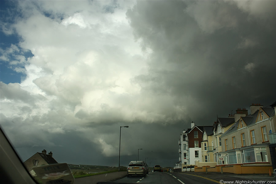
Look at the size of that thing, huge tilted updraught and intense precip core to the LHS, moving L to R, there's a huge gust front wrapped around that core. Along the horizon under that clear sector beneath the leading updraught is a distant row of buildings, that's Portrush, the Sea is just beyond those, compare the size of this storm with those buildings!. This was when I got my first text message from Paul Martin saying ''very nice cell just off the coast of Portstewart showing red and white returns on NW radar'', I was very grateful for this message, it confirmed everything I was seeing visually, the precip core looked very intense and the cell was so large it would have been seen from both Portstewart and Portrush, it extends far out of frame to the LHS. Paul also confirmed that the cell was over the Ocean which impressed me even more. I quickly text back saying ''I can see the cell, it's mad''. There's a small section on the video clip at 1 min 12 sec's which shows this same scene in dramatic fashion. We drove straight into town where the horizon was obscured for a time, between the buildings I could see a huge menacing gust front moving in, we encountered another roundabout and decided to get off the main road and get parked up as now was the time to catch the structure on this before it passed over us, I couldn't wait to get out from the car, my hand was on the door handle and the camera around the my neck while we were still in transit.
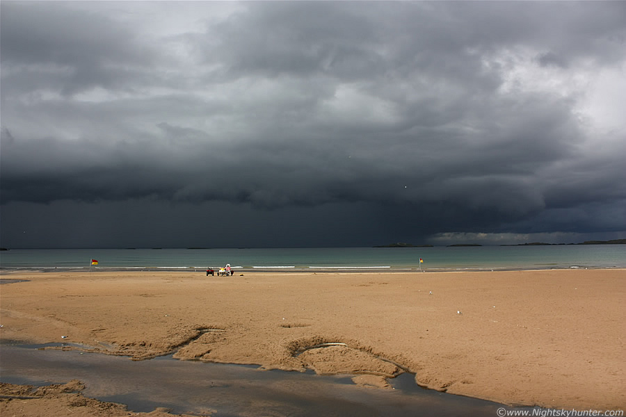 |
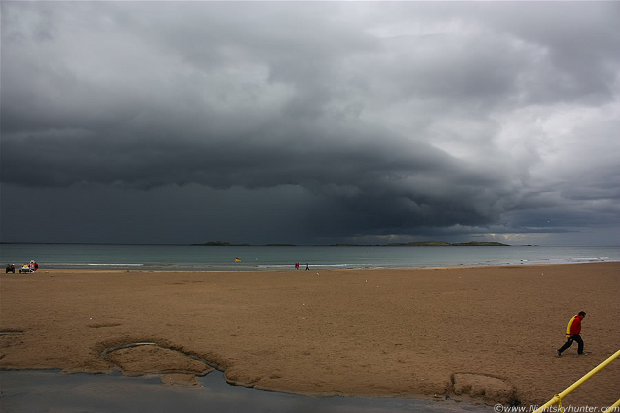
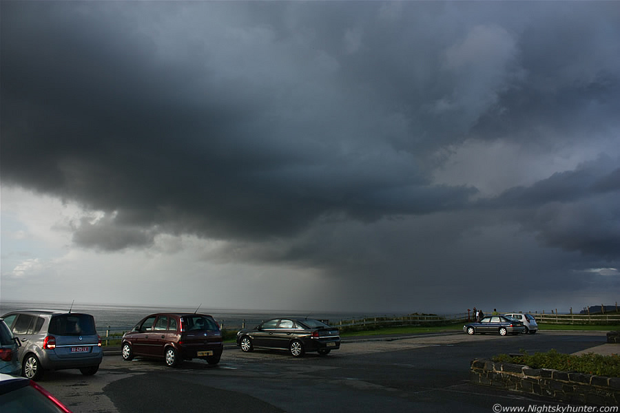
We pulled into a large car park which was at a perfect position looking directly across the Atlantic Ocean with 'White Rocks Beach' in the foreground, this storm intercept was perfect. I got another text from Paul ''sferic now too, your'e in business!'', I grabbed my DSLR, video camera, tripod, and ran across the car park towards the edge of the beach, then ran down a series of concrete steps almost knocking over a young couple in the process, they must have wondered what all the panic was about, I apologised and set-up my tripod on an elevated concrete walkway looking down on the beach. I set the video camera on the tripod and took video then began taking stills with the Canon 450D. The scene in front of me was fantastic, a huge dark gust front on the leading edge of that multicell, below was an intense dark precip core, below this was a beautiful aqua-green Sea, all contrasting against the bright orange sand which looked great in the sunshine. I saw a white c-g bolt fire out from the cell and hit the Sea which was fantastic, Paul was correct, I was in business!.
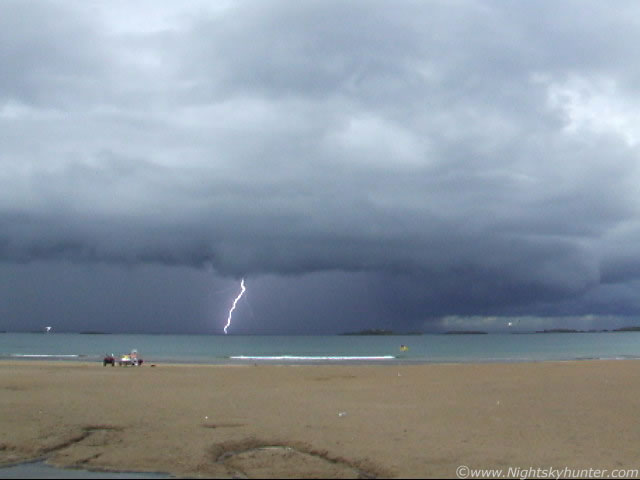 |
This is a still from the video footage showing c-g bolt number two with second order branching, on the video clip I slowed this scene down and you can see there are actually two flashes of lightning, one c-g followed by an I-c flash from within the cell. I couldn't hear any thunder due to the roar of the Sea and the loud calls of Seagulls which flew past me in high numbers.
 |
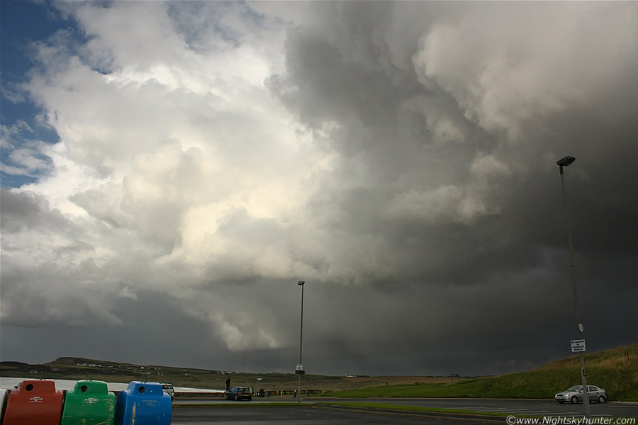
Zoomed in a little on that dark gust front. Visually I could see an obvious green hue to the precip core which often indicates the presence of hail, the camera didn't pick up this colour very well however you can see a hint of it on these images. The flags blowing in the wind indicate the direction of travel of this storm, it's approaching the beach while moving to the R at the same time. I saw another c-g to the far L of the frame, there's something magical about observing lightning over the Sea, it's very difficult to describe, kind of eerie and more dramatic than the same bolts over land would be, one also can't beat that perfect flat horizon. The lifeguard flag indicates that no swimming was allowed at this time, I don't really understand why because the Sea was very calm at the time, perhaps there were dangerous currents or maybe it was because of the weather. You can see the quad bike belonging to the life guard on the L and the Gulls scavenging on the sand. I was really delighted I made the decision to come here as the view was outstanding. I later learned that this was the best storm of the day in NI so things couldn't have been better.
 |
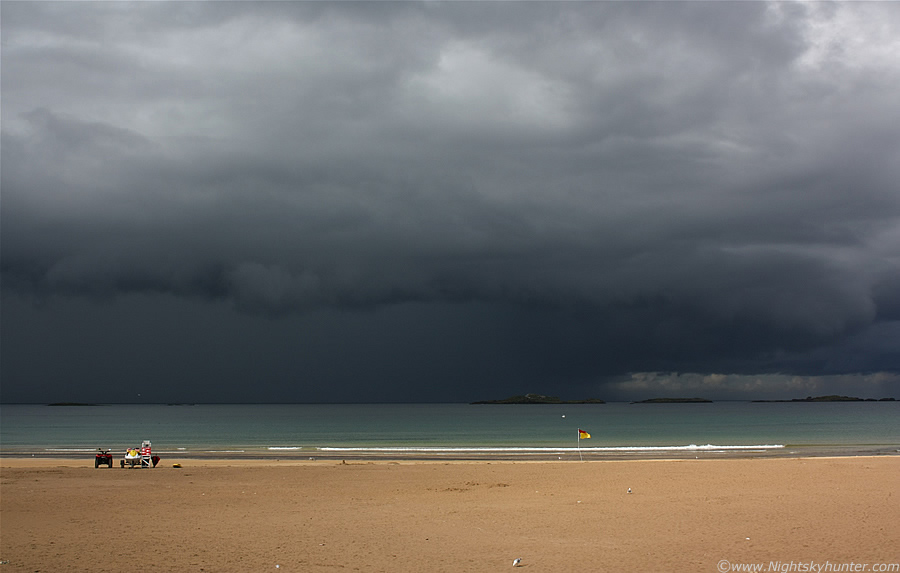
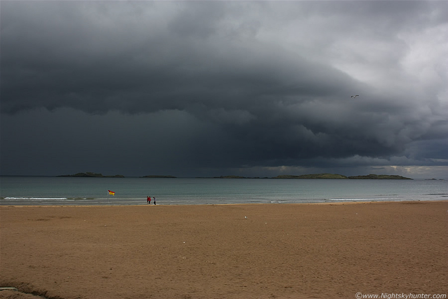
Wide angle shot of the gust front changing shape as it got closer, nice curved section to the R. The beach was very empty for the time of year, however there where people walking on it, I was quite certain that none of them were even aware of the storm about to hit, I saw no one even looking in that direction at all, it's amazing how switched off some people are. I saw two more c-gs on the far LHS of this frame which I didn't catch on video because I had the camera panned to the R section of this storm in order to document the structure. The sky was getting darker and darker by the min as the cell got closer. The gust front on this extends for at least twice the length of this 18mm frame away to the L, the N side of it was over the Sea and the S side over the town.
 |
Big guster about to hit, I saw 5 c-gs in total which was enough to make me content, it had been producing at least one more before we got parked according to Paul's message so it was a nice storm. The outflow gusts from the cell blew across the beach with drifting sand close to the surface and the temp dropped like a stone, I began to shiver as I was only wearing a slieveless shirt. The next blast of wind blew my video camera and tripod to the ground with the batteries falling out on the wet concrete, I quickly put them back in and turned it on, thank goodness it still worked. I was in danger of getting hit by lightning so I went back to the car, then the intense rainfall hit which was really nasty, I saw people running off the beach seeking shelter, they obviously hadn't a clue where the rain had come from. It took 15 min's for the precip to move through and glancing out the drenched passenger window I could see the S side of the gust front passing so low over the town that it seemed close to touching the rooftops, the clouds were solid and pure black and under the curved wing I could see the classic Whale's Mouth structure so common with these kind of outflow features. Finally the Sun broke out turning the back of the storm into a white wall of cloud with intense anvil high overhead, we watched it travel away to the NE heading for Scotland, it was a good storm which had made my day, anything else from now on would be a bonus.
We drove away from the beach onto higher ground and parked up on the side of the road where I watched some really crazy looking storm clouds approach on the leading edge of another cell, the clouds were rock solid with a phenomenal base, it was moving along the Sea at close range to the beach and was about to head inland with multiple segments of precip curtains getting dragged along with it. Two long duration rumbles of thunder came from it then it turned outflow dominant as it came inland. I had the video camera set-up on a picnic table trying to catch more lightning but soon had to seek shelter has the rain arrived so I got back in the car to wait it out, that was storm number two, short and sweet.
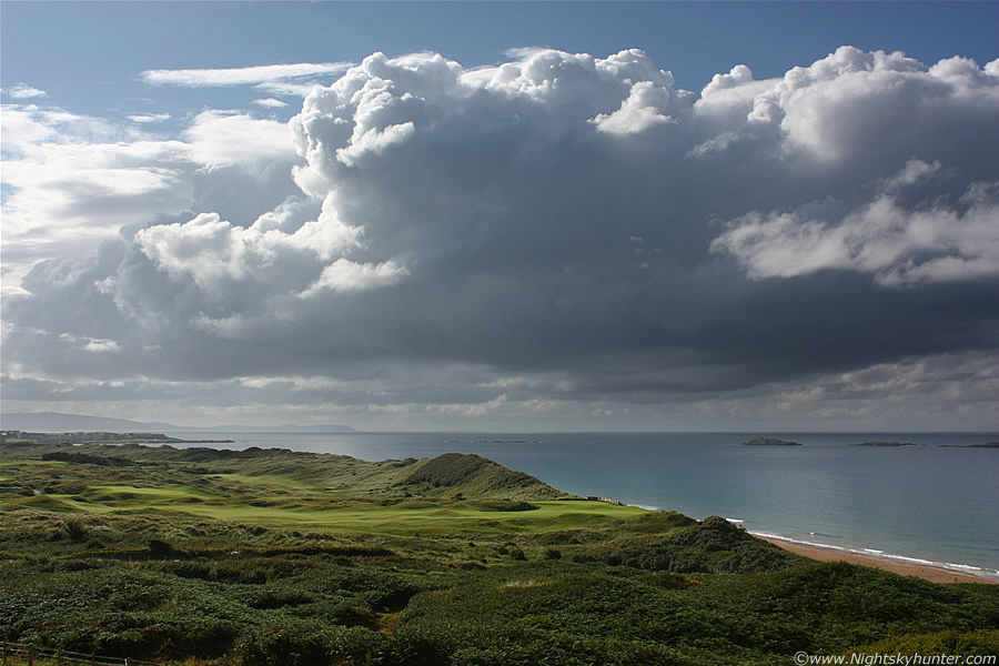 |
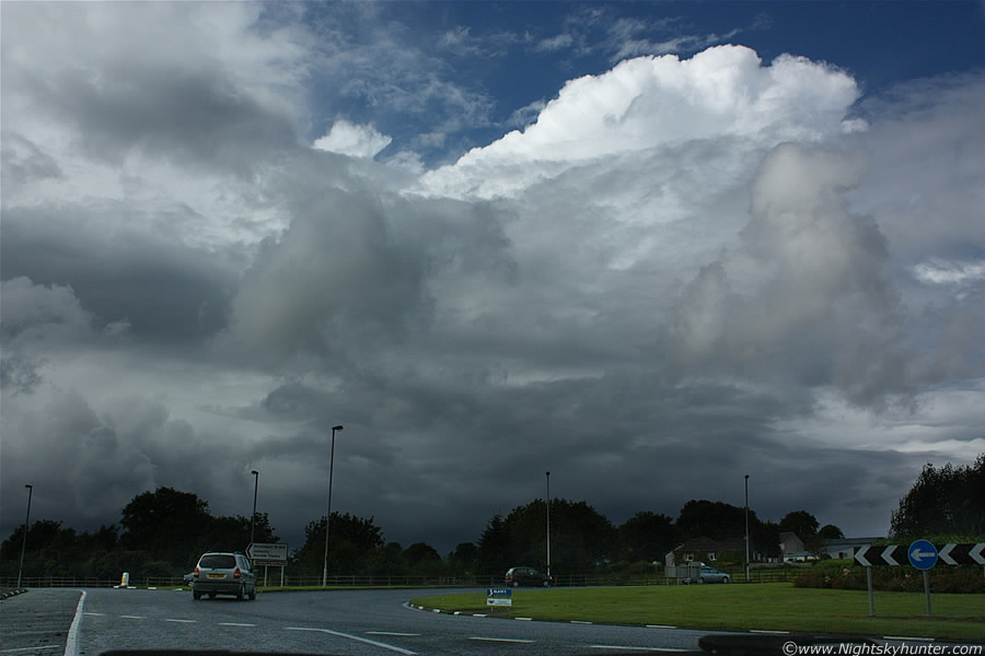
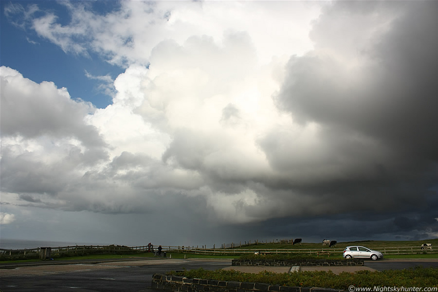
We drove further long the coast and pulled in again off the main road and stayed in a small lay by which provided us with a tremendous view along the entire N coast, this was the perfect place for watching storms and an incredible scenic location, check out this view of new convection bubbling up with the blue sea, green golf course, and beach at the same time. Paul informed me that there where new cells over Derry and Donegal with the latter heading my way but for the mean time there was a clearance in this area. We stayed here for a very long time watching, it was very warm and pleasant, I was almost cooking leaning against the metal frame of the car while I watched the sky. Towers were exploding up everywhere, both over the sea and inland, there where great sheared updraughts heading for Scotland and I could see very powerful convection miles away over the Donegal coast, those looked to be coming in this direction however they would take some time getting here. In the meantime I enjoyed myself in the Sun while having a nice snack as new cells grew in the distance, I couldn't miss anything from this vantage point.
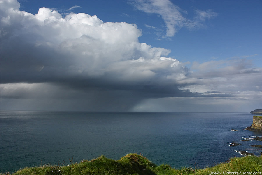 |
After a long wait we drove further along the coast and parked up in yet another car park where the view was spectacular. There was a huge line of convection stretching across a vast area of the water, none of it was serious enough to develop into a storm but it looked fantastic with reflections on the water, the showers looked very dramatic like the above one sporting a slanted precip core, this one had a line of towers going back in the direction of Portstewart, each had a solid base and explosive tops as they boiled up in the late afternoon heat. I watched them all very carefully as funnel clouds and waterspouts were possible from any of them.
 |
Another great line of showers heading in the direction of Scotland. The cliff faces here are truly amazing, you can see Dunluce Castle on the far RHS of the image. In hindsight I wish we had drove closer to the Castle and shot some convection over that structure however I never thought of it at the time. There's a fence along the edge of the car park to stop anyone getting too close to the cliff, I jumped over it and walked close to the edge which was rather dangerous, that's where the above two images where taken from, you can really feel your adrenalin going standing there I can tell you, you can see the edge there on the image.
A stunning line of cells approached from Donegal and took up the entire skyline, the tops were huge and back-lit by the Sun which made them even more menacing, the bases were black with a bulging area under the tallest cell which had that perfect kind of structured base which could drop something, it really did seem a tornado/waterspout was possible from this line so I stayed where I was. Next thing several Japanese tourists arrive with their cameras, they saw me on the other side of the fence and decide to join me lol, everyone of them were taking images of the cliffs and Dunluce Castle however I was the only one there shooting the storm clouds, I felt like an odd ball because no one else seemed interested in the clouds, perhaps they didn't know there was a risk of waterspouts.
 |
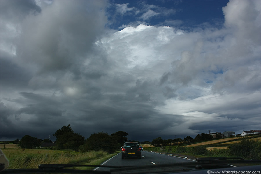
That huge line of cells then blew inland, in the above image I'm looking at the dark base of the first cell in the line, the others extend out of frame to the L. To the R is a mushy area where a shower is breaking out. Looking straight overhead I could see the tops of huge anvils and calvus towers, the anvils were getting sheared off in the strong flow so I knew my chances of getting more storms were over for the day, however new towers continued to explode up in the early evening heat, instability was still very good at this with 600 CAPE and LIs of -2. I was really after funnel clouds from now on so I watched every base intently, including those much further inland. That's the fence I was talking about, on the side of that is the cliff edge where I took those other images from, to the R you can see a group of people standing at that very spot, there's a spotting scope set-up for visitors to scan the Ocean for ships and so fourth.
 |
The line of convection moved further to the E and inland, they looked fabulous when the Sun broke out and illuminated the back of these cells with great intensity. Out of frame at the top where several enormous updraught towers billowing skyward along side several wispy anvils which were getting ripped to pieces in the shear. What to do now?, I knew there would be no more storms today however I didn't want to give up yet because there still could be a funnel cloud or at the very least a nice convective photo opp as the Sun was now at that favourable angle for great depth, contrast, and warm colour, we had come this far so I decided we would not give up now, we would chase these cells along the coast. Just as I was getting in the car I noticed an area of cloud rotating, rather slowly to be honest, however that got my attention. In the above image the white block of cloud to the L of the Cows and behind the precip was that area of rotation so we hit the road once again.
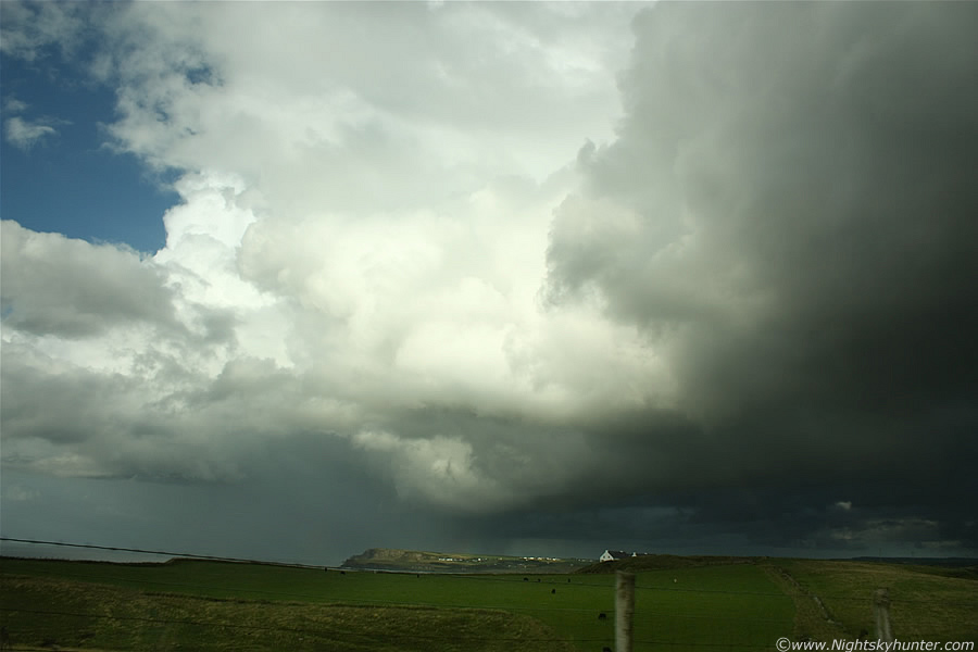 |
These are the kind of scenes I like, high contrast storm clouds sporting great dynamic range with areas of bright highlights and dark regions sporting complex structure. These were again snapped through the windscreen as we gave chase along the roads. Our destination was Portballintrae, you see that white building on the hill?, our target area was on the other side of that, I knew there was a good car park in that area near the Ocean shore which would be perfect for watching these cells from.
 |
A great scene to be chasing, my eyes were scanning back and fourth like a radar beam watching for funnels. Note the small segment of red primary rainbow which has formed on the back of the precip core, that remained visible for a very long time.
 |
On the W side of Portballintrae, we needed to get through the town first before we got to our target area. The cell itself is actually over the Giant's Causeway at this time. The passenger window was down for this one.
 |
Now racing along the main road in Portballintrae, those high contrast storm clouds looked fabulous with the houses and sunlit B&Bs below. It would have been great to have caught a white funnel hanging down above the road there. We where almost at our destination, which was on the other side of that crest on the road to the L, you can see a slither of the Ocean between the tax disk and silver car, that's where we would be parking soon, however it was a race against time as those cells where racing away fast.
 |
At last we made it just in time and pulled over in Portballintrae car park on the W side. The rear of those large cells looked fantastic as they drifted at low level across the N. Antrim coast line heading E towards Scotland, they are moving from L to R and into the distance, hail was visible falling in fine strands and that bow was still there, on occasion there was a secondary bow also. I ran a cross the car park and stood on that wall on the other side.
 |
This was the great scene which ended the day, a mass of Cbs and towers crossing from Ocean to land with the low evening Sun casting the clouds into gorgeous warm colours while the segment of bow intensified, I felt very happy and content standing here in the Sun shooting this scene, I didn't stop pressing the shutter until those cells vanished behind the hills. I checked my camera, I had taken over 300 images today. Then began the long drive home, the Sun was our companion all the way back S, it made for quite a sight with a vivid glitter path splashed across the Atlantic. More convection greeted us inland, outside Portstewart I saw a glorious orange cell with vivid red primary and secondary sunset bows, they looked typical of a scene from the end of a US storm day, this was followed by another orange-coloured cell in Coleraine and then finally we entered the flat open country of Garvagh, Swatragh, then back to Maghera where the sky was bright and the weather peaceful. It had been a 100% success and a fun day out. I have spent alot of time at the N coast this year, however this is the first time I have intercepted thunderstorms there so I plan to be back again at periodic intervals for the remainder of the year, this place is great for gales, storm force winds, mountainous seas, huge waves blowing over cars, coastal thunderstorms, and waterspouts, all complimented by fabulous countryside so the photogenic potential here is too significant to ignore.
Here's a video clip showing the huge multicell as we chased it through very various towns before intercepting it at White Rocks Beach, Portrush where you can see the advancing gust front with c-g lightning bolt hitting the Sea. Thanks very much for reading.
Martin McKenna